Understanding the geography of the Holy Land can help us better understand Scripture. Here are some of the most important geographical features to know.
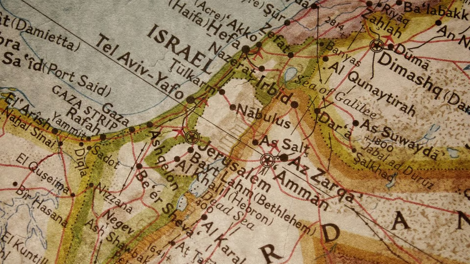
ntmw/E+ via Getty Images
Learning about the geography of the Holy Land is important because some of what is recorded in Scripture becomes clear only when we consider biblical geography.
In this short article you will find examples that illustrate why the geography of the Holy Land matters. This land is not large (the distance from Dan in the north to Beersheba in the south is only about 150 miles), but its impact on history and prophecy is great.
Promised Land, Holy Land
The best place to begin a consideration of the geography of the Holy Land is to look at what the land itself meant to the people of ancient Israel. It was not merely a place; it was a significant part of the covenant the nation made with God.
God promised that land to Abraham and his descendants (Genesis 12:1; 13:15). He confirmed His promise to the people of Israel as He freed them from Egyptian bondage, describing the land as one “flowing with milk and honey” (Exodus 3:7-8, 16-17).
To the ancient Israelites, this promise meant more than the land itself. It was also about their covenant relationship with God. As noted in The Moody Atlas of Bible Lands, “Israel’s identity, security, and prosperity were all the direct results of being in the land” (p. 4, emphasis original).
Knowing something about the geography of the Holy Land can greatly enrich your study of God’s Word.
We now call the land of Israel “the Holy Land” because that terminology recognizes this part of the world as a place that is special to a holy God, was set aside for a holy purpose and was given to a people who were themselves to be holy (Leviticus 19:2; Zechariah 2:12).
The land God promised Abraham was to extend “from the river of Egypt to the great river, the River Euphrates” (Genesis 15:18). Another passage describes the land as ranging “from the Red Sea to the sea of the Philistines, and from the wilderness to the River Euphrates” (Exodus 23:31, New American Standard Bible).
The Fertile Crescent and the Holy Land
Much of the Near East is barren desert. Ancient Israel’s neighbors to the east—Ammon, Moab and Edom—all bordered the Syro-Arabian Desert. This desert skirted along their eastern boundary all the way into Syria.
The desert eventually gives way to a well-watered area along two more-or-less parallel rivers, the Tigris and Euphrates. Egyptologist J.H. Breasted called these lands the “Fertile Crescent.” The cultures of ancient Mesopotamia thrived in the lands between the two rivers.
Travel through the inhospitable desert was difficult, so most travel and trade followed that crescent into the Levant, which the Holman Bible Atlas defines as “the habitable land along the eastern Mediterranean coast sandwiched between the Mediterranean Sea on the west and the Syro-Arabian Desert to the east” (p. 8).
Trade routes and riches
The land of Israel controlled a strategic position. With a hostile desert to its east and the Mediterranean to its west, the Holy Land was the logical corridor linking Egypt in the south to the nations north and east of Israel.
At the same time, its position between several seas was important. Situated between the Red Sea to the south, the Mediterranean Sea to the west and the Dead Sea to the east, Israel was a land bridge connecting the northeast coast of Africa and the west coast of the Arabian Peninsula to the Mediterranean world.
The location of Israel was a significant factor in bringing affluence to God’s people, particularly during the reign of Solomon. For instance, he built a fleet of ships at Ezion Geber (1 Kings 9:26-28), on a gulf on the northern tip of the Red Sea, and the men assigned to those ships brought in an enormous amount of wealth.
The land routes also brought riches to the nation. Two major highways, a coastal highway (the Via Maris) and another less-traveled highway along the ridgeline of the Judean mountains, traversed ancient Israel, even during the time it was known as the land of Canaan.
Using these north-south highways made it easy for Solomon to collect money from all the kingdoms under his control, “from the River [Euphrates] to the land of the Philistines, as far as the border of Egypt. They brought tribute and served Solomon all the days of his life” (1 Kings 4:21).
Trade routes and turmoil
The same strategic position that brought Israel wealth, however, also brought disaster in the nation’s times of sin and subsequent weakness. That’s because there was continual conflict between Egypt to the south and the nations of the Fertile Crescent, and Israel’s geography offers little natural protection from enemies.
When Israel was weak, armies crossed its territory with impunity. Baker’s Bible Atlas points out that the Holy Land “frequently served as a buffer state between rival nations of the ancient world” (p. 11).
One such occasion resulted in the death of Judah’s beloved King Josiah. Egypt had aligned itself with the failing kingdom of Assyria against the rising threat of Babylon. To lend support to Assyria, Pharaoh Necho intended to take his army through Judah.
Josiah chose to oppose the Egyptian armies, presumably because of what Assyria had done to the northern tribes of Israel, taking the people into captivity (2 Kings 17:5-6). Josiah made his stand at Megiddo (2 Kings 23:29).
Why Megiddo? This ancient city was built on a hill overlooking the Jezreel Valley. More importantly, it was at this point that the coastal highway turned inland to avoid a steep incline up to Mount Carmel. Megiddo controlled the highway.
This site has been so strategically vital to armies through the millennia that dozens of battles have occurred there. In fact, its strategic value will continue until the end times, when the armies of the beast power will gather there (Revelation 16:13-16; 19:19-21).
Topography of the Holy Land
Much of the southern half of Israel can be divided into three zones: the relatively flat coastal plain, the Shephelah (a transition zone also known as the Judean Foothills) and the highlands.
The ancient kingdoms of Israel and Judah and neighboring peoples. Map base image: iStockphoto.com/FrankRamspott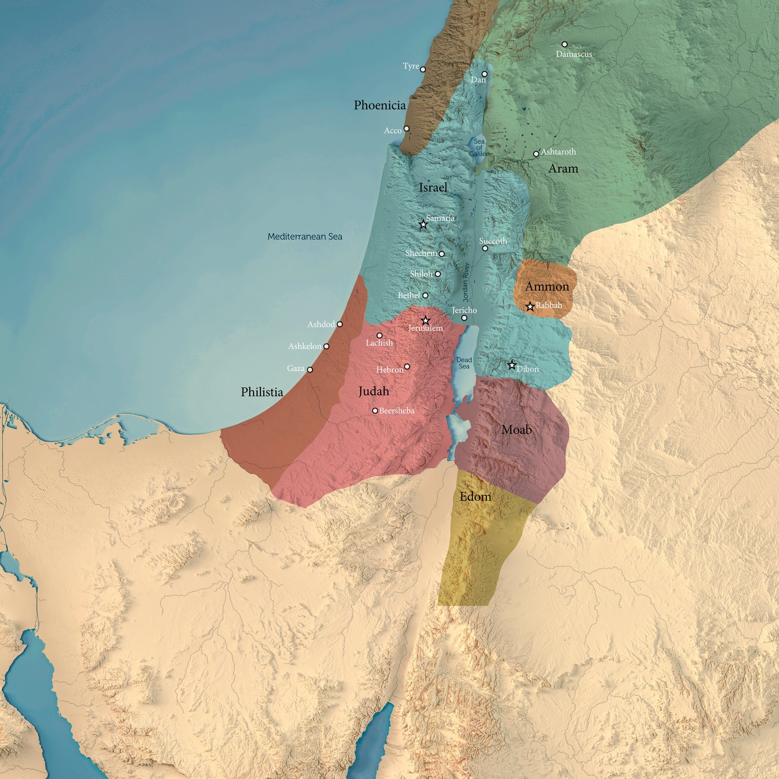
Much of the highlands is interspersed by deep ravines, called wadis. Wadis are intermittent streams, flowing only during the rainy season.
These topographic features were an important factor in the efforts of the Israelite tribes to conquer their enemies. Why did topography matter so much?
Israel’s most intractable enemies were those with more advanced weaponry, particularly chariots. Chariots depend on speed to be effective, but speed is not possible in more rugged terrain. Many places were simply impossible for chariots to navigate.
Incomplete conquest
For that reason, the Israelite conquest was not complete or immediate. The Zondervan Pictorial Encyclopedia of the Bible explains that the “conquest was at first limited to the hill country because of the risk of fighting the Canaanites armed with chariots on the plains” (Vol. 1, p. 782).
These formidable weapons were the fear of the tribes of Ephraim and Manasseh. The tribal leaders admitted this fear to Joshua, telling him that “the Canaanites who dwell in the land of the valley have chariots of iron” (Joshua 17:16).
A similar story was true for the people of the tribe of Dan, who were unable to take possession of their allotment. As the book of Judges tells us, “the Amorites forced the children of Dan into the mountains, for they would not allow them to come down to the valley” (Judges 1:34).
Water in the Holy Land
In places where rain is abundant or in nations with significant rivers, water is often taken for granted. This would have been true for those along the rivers of Egypt, Assyria and Babylon.
It is not the case in the Holy Land. There are no major rivers in all of Israel; many of the so-called rivers mentioned in the Old Testament are wadis. That designation includes the Arnon (Deuteronomy 2:24) and the Jabbok (Joshua 12:2).
Even the Jordan River is relatively small. Its depth ranges from 5 to 12 feet (1.5 to 3.5 meters), and its width is between 80 and 180 feet (24 to 55 meters).
John the Baptist carried out his work of baptizing at the Jordan River “in Aenon near Salim, because there was much water there” (John 3:23). The fact that the Jordan, as small as it is, is described as having “much water” highlights how little water was available in parts of the Holy Land.
A gift from God
Much of the fresh water for ancient Israel, particularly in the south, came from springs, cisterns and wells. (Galilee in the north was blessed with the freshwater Sea of Galilee.)
Cisterns and wells are built by humans. The first is designed to collect rainwater, and the second to reach water deep under the land surface. Springs, on the other hand, occur naturally, bringing groundwater to the surface.
It’s not surprising, then, that both springs (sometimes called fountains) and rainfall are viewed in the Bible as gifts from God. One of the psalms proclaims that God “sends the springs into the valleys; they flow among the hills. They give drink to every beast of the field; the wild donkeys quench their thirst” (Psalm 104:10-11).
Jesus even used the imagery of such a spring to describe the gift of eternal life: “But the water that I shall give him will become in him a fountain of water springing up into everlasting life” (John 4:14).
Water is precious and necessary for life. No wonder the Bible so often equates it with both physical life and eternal life (Revelation 21:6; 22:17).
Is the geography of the Holy Land important?
You can read the Bible and understand what is most valuable without knowledge of biblical geography. On the other hand, knowing something about the geography of the Holy Land can greatly enrich your study of God’s Word.
As you read Scripture and come across passages that allude to some place or geographic feature (such as Shiloh or Jerusalem), take the time to look at a Bible atlas. You might be surprised at how much this effort will pay off.
About the Author

Bill Palmer
Bill Palmer has devoted much of his life to writing and editing. He studied journalism at TCU in Fort Worth, Texas, prior to attending Ambassador College in Pasadena, California.